

During Heritage Week, from February 19 to 27, you will have a chance for a fascinating exploration along the course of Mississauga Road. The City of Mississauga Culture, Museums and Parks teams are working in collaboration with Heritage Mississauga to present an outdoor recreation-themed Heritage Week campaign.
Daily social posts will be shared by Culture, Museums, Parks and Heritage Mississauga on their social media channels, all focused on exploring and connecting with Mississauga Road. A selection of the daily posts will direct people to engage with the Goose Chase app, where users will be encouraged to visit identified locations and learn about the history of Mississauga using the scavenger hunt tool. Each day of the campaign will focus on an area along Mississauga Road, including Port Credit, Erindale, Streetsville and more!
https://www.heritagetrust.on.ca/en/index.php/calendar?e=89217&d=2022-02-19&e=89217&d=2022-02-19
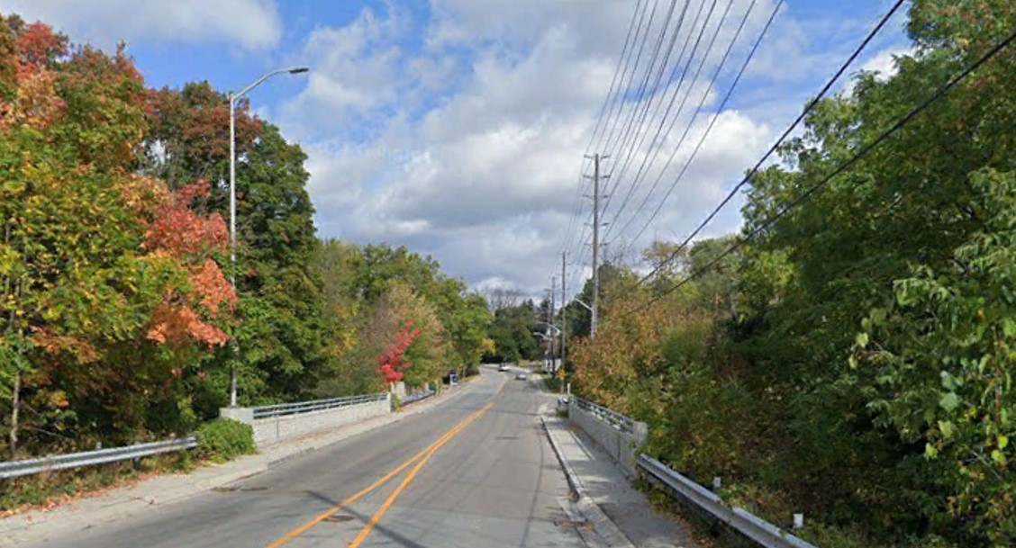
Meandering along Mississauga Road today, one can catch glimpses into several layers of history; the journey along Mississauga Road is in part a journey through time. The road shares a story that is akin to that of the Credit River – just as the river meanders through Mississauga, Mississauga Road follows the course of the river closely as it traverses our city from Lake Ontario to our Northern border.
Both the river and Mississauga Road were once vital lifelines and routes of transportation in the early years of settlement, their quiet and occasionally rural ambience obscuring their importance to early life in what would become the City of Mississauga. The story of Mississauga Road has many chapters, or geographic sections as it were, and that will only be touched on briefly here.
First, let’s start with the route itself; much of Mississauga Road, south of modern Eglinton Avenue, follows an early Indigenous trail that rambled along the course of the Credit River, slightly removed from the floodplains. The route itself deviates from the traditional cadastral survey grid favoured by British surveyors, and as such much of its course is a given road – that is, a route that is accepted and travelled but does not, in parts, conform to the survey. This is visually evident from the southern section of the road, south of Eglinton Avenue to Lake Ontario.
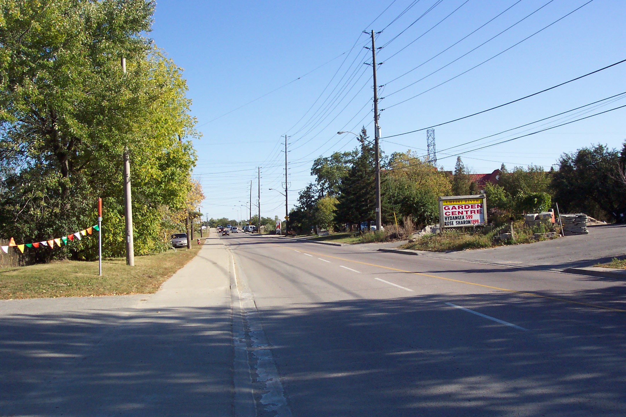
North of Eglinton Avenue, Mississauga Road follows the established survey into Streetsville. The road was planked in the 1850s, became a corduroy road in the 1860s, and macadamized and was layered with gravel (referred to as “stone”) in the 1890s. When it was first paved, in the 1950s, evidence of the early wooden planks was found under the gravel. Perhaps some of these remnants, or remnants of stump fences, remain buried under the modern road we travel on today.
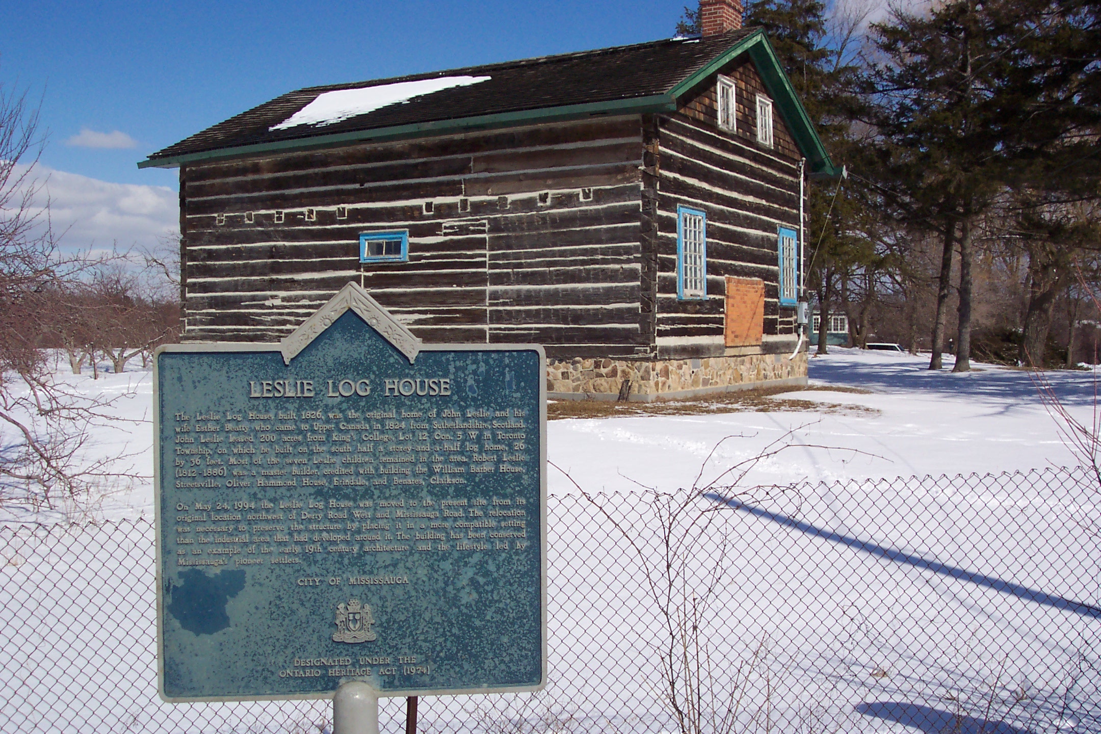
Along its route, modern Mississauga Road passes by former inns and stagecoach stops dating to the 1830s and 1840s; large estates dating from the early 1900s; stone walls which hint at a landscape, and a land use, from the past; humble family dwellings and homesteads dating to the early 1850s; a relocated early settler log house; farming remnants that remind us of our not-to-distant agricultural and fruit growing roots; the site of the former Credit Mission Village of the Indigenous Mississaugas of the Credit (commemorated today with the Sacred Garden – Chi-twaa Tigaanes); a venerable stone church that overlooks the intersection of the Credit River, Mississauga Road and Dundas Street; an old school and a modern University – all are dotted along the course of Mississauga Road, offering reflection on several layers of history in a single glance.
Although the date of the official adoption of its modern name is not certain, in the past, sections of Mississauga Road carried other names. These names included: Swamp Road, Cedar Swamp Road, Coldspring Road, Spring Road, Springbank Road, Springfield Road, Indian Village Road, Stone Road, Streetsville Plank Road, and the Streetsville Stone Road – likely amongst others. However, the name of the road as “Mississauga Road” predates the naming of our city.
As you travel along Mississauga Road, one passes through areas that were also once known to locals by other descriptive names: the Oneida Country Club, IALFA, Oakridge Farm, Arcadia, Glades of Fleet, Ross’ Hill, Maple Hill, Windy Hollow, Cedar Swamp, Springbank, Sawmill Creek, Stonehouse Road and Rogers’ Road, amongst many others. For those who like a bit of a challenge, can you find the stone pineapples? They connect with the former Oneida Country Club.
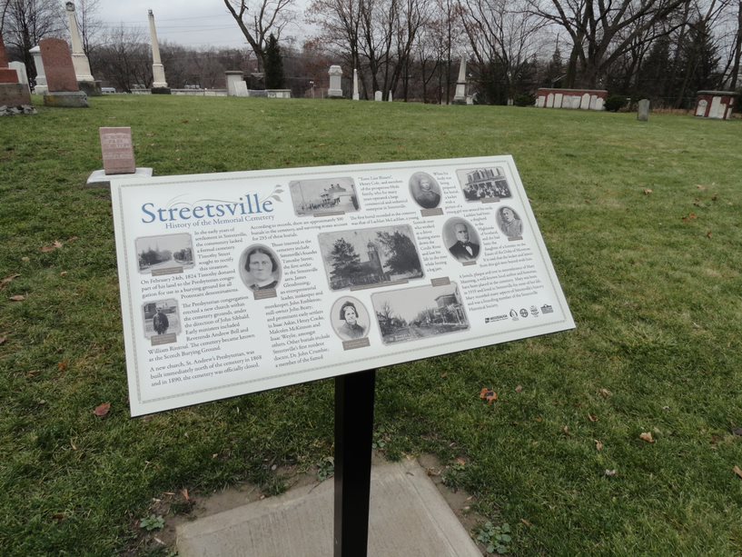
Some other early settling families are commemorated in modern street names which intersect with Mississauga Road: Harkiss Road, Featherston Drive and O’Neil Gate, amongst others. Many of these early families are buried in the two cemeteries behind St. Peter’s Anglican Church at the corner of Mississauga Road and Dundas Street West.
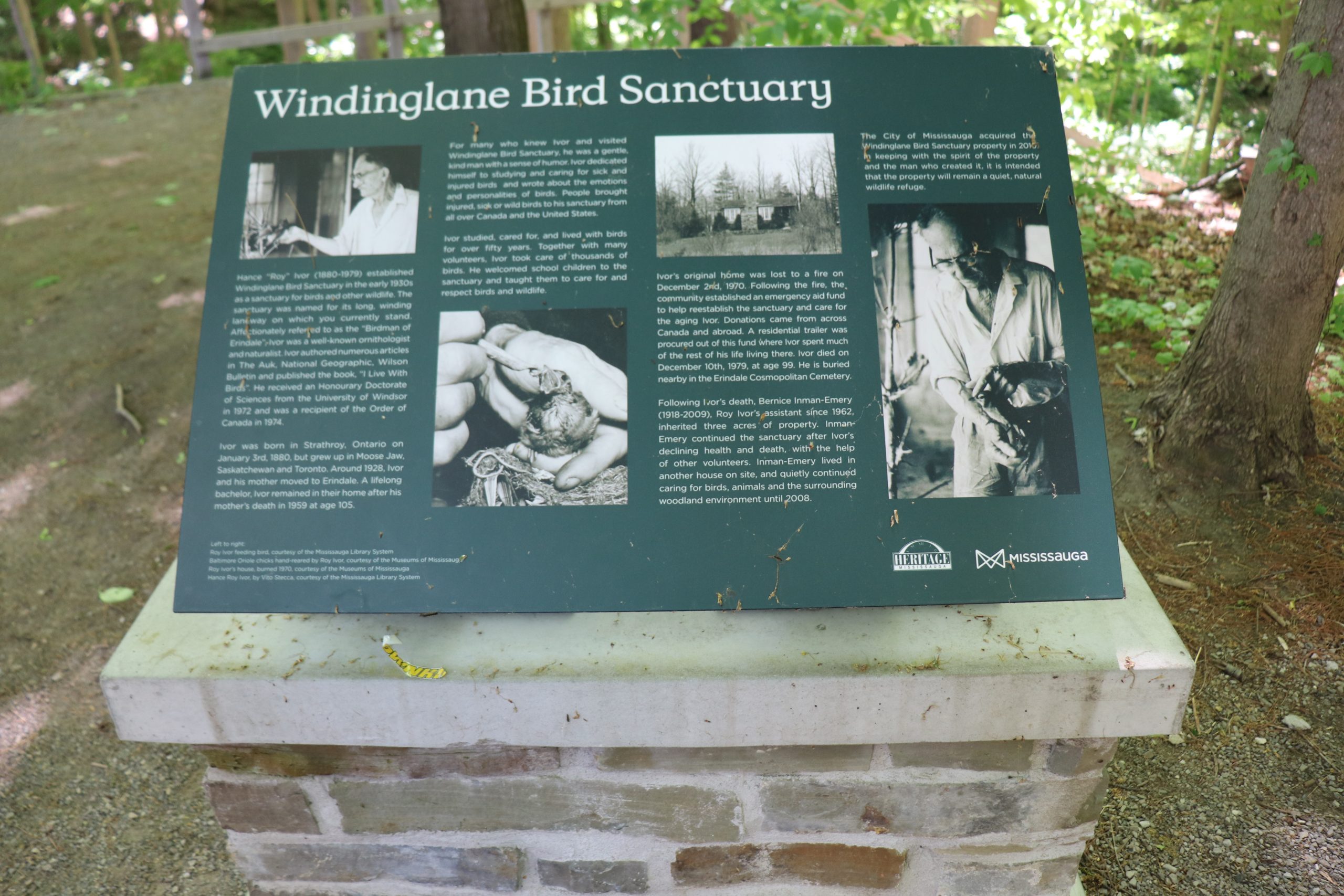
Along its course, Mississauga passes by the former site of Windinglane Bird Sanctuary and an interpretive plaque remembers the beloved stories of Roy Ivor and Bernice Inman.
The road also passes by the former site of Braeburn, once the home of Ronnie Hawkins, who hosted John Lennon and Yoko Ono here in 1969. Nearby is one of Mississauga’s true gems – Riverwood. The property offers a wonderful chance to commune with nature, but also to explore heritage with several significant heritage buildings preserved on site.
As we travel into Streetsville, Mississauga Road reverts to an earlier established street name – Queen Street. An earlier article in this series explored the obscure origins of the name for Queen Street. The route of Mississauga Road (as Queen Street) takes us through the heart of historic Streetsville, and intersects with several significant historic sites and heritage properties – too many to list! Some fascinating points to ponder along this section of the route include intersecting roads – Barbertown Road, Reid Drive, Mill Street, Ontario Street and Alpha Mills Road. All of these names reflect on historic milling industries that once provided essential services and employment, and connected the growing community to the ebbs and flows of the Credit River itself.
As you travel along Mississauga Road today, you are, without a doubt, travelling in the footsteps (and wagon wheels) of those who have come before you – including the Rebel Leader William Lyon Mackenzie who traversed down the course of Mississauga Road when fleeing from authorities following the Rebellion of 1837! And there are many more stories to explore! Mississauga Road is truly a heritage route!
Connect with us on Facebook, Twitter and Instagram:
City of Mississauga Culture accounts: @saugaculture
City of Mississauga Museums accounts: @saugamuseums
City of Mississauga Parks accounts: @saugaparksrec
Heritage Mississauga accounts: @heritagemississauga
And do not forget to download the Goose Chase app!
Comments are closed.