

In last week’s article we explored the name origins of Burnhamthorpe Road, and how local history has passed down the story of a resident named J. Abelson who had the idea to name the rural hamlet after his own birthplace (and the birthplace of Lord Horatio Nelson). In time, the name of the hamlet became applied to the road.
Well, at least part of the road at first.
Before the concession road we now know as Burnhamthorpe Road was named, many informally referred to it as the “Back Line”. The road itself was laid out as part of the 1806 survey of Toronto Township undertaken by Samuel Wilmot. When the name Burnhamthorpe Sideroad came into local usage, there was one problem: Burnhamthorpe Road as we know it today did not cross the Credit River.
The folks on the west side of the river had no use, and no place name association for the name Burnhamthorpe. For many of them, it was Rogers Road, with a short portion of it being known as the Adamson Sideroad for a time.
As a concession road, the right of way established by the early surveyors was more-or-less a straight line across the landscape.
If you take a ruler today to a modern map of the City of Mississauga, you find that Burnhamthorpe Road, east of the Credit River, follows that straight line as first laid out by surveyors over 200 years ago.
However, on the modern roadscape, as you cross the Credit River heading west, modern Burnhamthorpe Road veers southward from its original course. This happened in 1980 when Burnhamthorpe Road bridges over the Credit River and Mullett Creek were completed.
If you go back to the straight line, you will find that there are roads on our landscape today that follow the original concession road alignment: Fifeshire Court, Burbank Road, and Rogers Road.
Collectively they are the ghosts of “Old Burnhamthorpe”, still peaking through on the modern landscape.
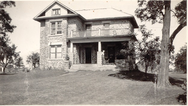
Fifeshire Court, which follows part of the old Burnhamthorpe alignment, traverses through part of what was the Wolfe family farm. What is believed to a c1860 farmhouse survives as a private family home today.
Modern Burbank Road was known locally as the Adamson Sideroad for a time as it led past the prominent Adamson family farm. Known to the family as The Homestead, Alfred Adamson established a large farm here in 1863 which remained in the Adamson family for over 100 years.
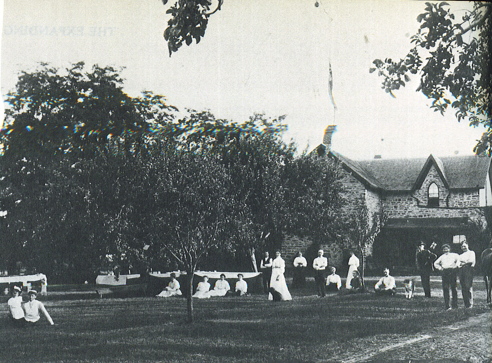
The Homestead, built in 1863 and remodelled after fire in 1911, remains on our landscape today as a private family home, anchoring modern Burbank Road to its historic roots.
A small section of the original Burnhamthorpe Road route still carries the name of Rogers Road today, running east off of Glen Erin Drive and just to the north of modern Burnhamthorpe Road.
The name for Rogers Road comes from the Rogers family who settled on Lot 33, Concession 2, NDS (North of Dundas Street). Joseph Rogers was born in 1811 in Tipperary, Ireland, and came to Canada in 1831. Joseph (1812-1901) and his wife, Eliza (nee Cook, 1821-1904), had eight children: Sarah (1842-1927), Samuel (1846-1936), Henry (1846-1930), William (1850-1941), James (1850-1917), David (1852-1916), Joseph Jr. (1855-1874), and Thomas (1862-1941).
The family became quite prosperous and was active in the Orange Lodge and the Temperance Lodge in Streetsville. The Rogers family boasted one of the first stumping machines in Peel County and became noted for their shorthorn cattle. The Rogers farm property was sold to Erin Mills Developments in 1956, but they are remembered on the landscape today, as is the original course of Burnhamthorpe Road, in the name of Rogers Road.
Comments are closed.